How to get from Madrid to El Escorial: Complete travel guide

Where is El Escorial located?

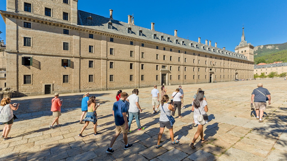
Address: San Lorenzo de El Escorial, Madrid, Spain

Find on Maps

Perched on the slopes of the Sierra de Guadarrama, El Escorial sits about 45km northwest of Madrid. This historic town is dominated by the famous Royal Monastery, surrounded by charming streets, scenic gardens, and nearby viewpoints.

Getting to El Escorial by public transport

Travel time: 52 mins from

Start station in Madrid: Madrid Chamartín

Destination station: El Escorial Station

Timings: Trains are available every 30 mins from 5am to 11:30pm

Hop on the C-3 line from Madrid Chamartín toward El Escorial. The station is a 10-minute walk from the Monastery. This is usually the fastest and most budget-friendly way to visit.

Travel time: 1 hr 15 mins from

Start station in Madrid: Moncloa bus terminal

Destination stop: El Escorial bus station

Timings: Buses every 20–30 mins, from 6:30am–10pm

Board buses operated by La Sepulvedana at Moncloa; buses run through scenic roads, passing quaint villages and offering great countryside views.

Getting to El Escorial by car

Travel time: 40–70 mins from Madrid city center

Distance: 53.2km

Routes:

  • Fastest: Take the A-6 highway from Madrid for a direct drive to El Escorial, usually 40–60 mins depending on traffic.
  • Scenic: Take the M-505, winding through charming villages and rolling countryside, offering beautiful views of the Sierra de Guadarrama.

No restricted zones within El Escorial, but narrow streets near the monastery can get crowded.

Parking facilities

  • Aparcamiento Discapacitados: 11-minute walk away from the monastery (Find on Maps)
  • Aparcamiento Monasterio: 10-minute walk away from the monastery (Find on Maps
  • Parking Herrería: 11-minute walk away from the monastery (Find on Maps)
  • Public parking BENCAR EGS, S.A.: 4-minute walk away from the monastery (Find on Maps)
Group of tourists walking towards San Lorenzo de El Escorial in Spain.
  • Exploring the Sierra de Guadarrama area on foot is a treat. 
  • Walking to El Escorial from the train station or nearby hotels takes 10–15 mins through charming streets, small cafés, and scenic views of the surrounding mountains. 
  • If you’re cycling, the quiet roads from Madrid outskirts make for a leisurely ride, with plenty of photo ops along the way.
  • El Escorial is also mostly accessible for visitors with reduced mobility. 
  • Paths to the Monastery entrance are smooth, and elevators are available inside. 
  • Buses have ramps, and some nearby parking lots offer dedicated spaces and discounted rates for guests with disabilities. 

Getting to El Escorial from nearby hubs

Segovia to El Escorial

Travel time: 40 minutes by car, a little over 2 hours by bus

Segovia is about 53km northeast of El Escorial. By car, take the AP-6 and then M-600 for the fastest route. Buses run several times a day from Segovia bus station to El Escorial, offering scenic countryside views along the way.

Ávila to El Escorial

Travel time: 50 minutes by car, 1 hour by bus

Ávila lies roughly 70 km west of El Escorial. Drive via AP-51, then AP-6, or catch a regional bus from Ávila bus station. The drive passes historic towns and stretches of the Guadarrama mountains.

Madrid-Barajas Airport to El Escorial

Travel time: 50 mins by car, 1 hr 40 mins by bus

From the airport, the fastest route by car is via M-40 and A-6. For public transport, take Cercanías C-3 from Chamartín station (reachable via metro or taxi from the airport) toward El Escorial.

Toledo to El Escorial

Travel time: 1 hr 30 mins by car, 2 hours by bus

Toledo is around 120 km south of El Escorial. Drive via A-42 and M-50 through scenic plains and rolling hills. Public transport options are limited, so driving or private transfers are recommended.

Frequently asked questions about Madrid to El Escorial transfers

Yes, the Valley of the Fallen is just a 20-minute drive from El Escorial. Many El Escorial day trips combine both in a single trip.